Blog
Build Your Own GPS Area Measurement App for iOS – Ready-to-Use Source Code by Softmize App Studio
This isn’t just a simple GPS tool — it’s a complete land measurement and field mapping solution built for precision, performance, and reliability.
Farmers, real estate professionals, surveyors, and explorers can easily measure any land area, calculate distances, and save marked points (POI) on the map. Developers can rebrand, redesign, and launch their own version instantly under their own App Store account — no coding from scratch required!
If you’re a developer, agency, or startup looking to launch a high-quality Area Measurement & Land Mapping App without spending months on coding, designing, and testing — this ready-made iOS Source Code + UI Kit Template is the perfect solution. Built with professional-grade accuracy, modern UI, and clean architecture, this complete app package enables you to build and launch your own GPS Field Measurement App in record time.
This is not just a simple template. It’s a full-featured, production-ready land measurement app framework with everything already integrated — GPS accuracy, area measurement tools, distance calculator, location markers, POI saving, onboarding screens, and an advanced mapping interface. Developers can instantly rebrand, redesign, and publish it to the App Store under their own account with zero hassle.
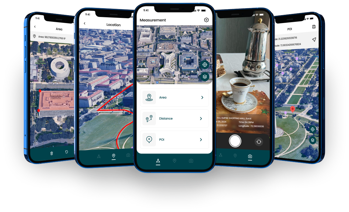
The app comes with a beautifully crafted UI Kit, designed to deliver a clean, modern, and high-performance experience. All screens — Home, Measurement Dashboard, Area Tool, Distance Tool, Location Saving, Settings, and Map View — follow a premium look that feels polished and ready for customers. Every UI component is fully editable, allowing you to adjust colors, icons, fonts, and layouts to match any brand identity.
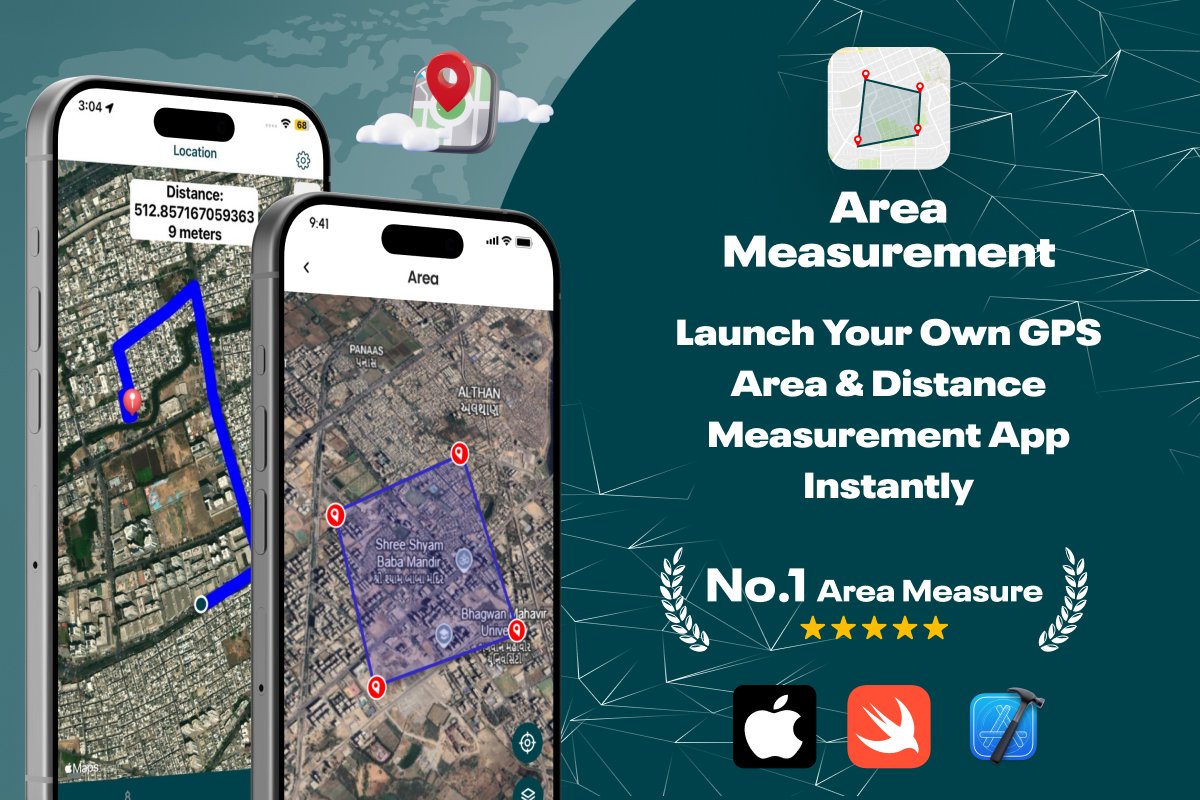
The core engine includes a powerful Area Measurement system, allowing users to draw boundaries on the map and instantly calculate field size in square feet, square meters, acres, hectares, or any other unit. This feature is widely used by farmers, surveyors, real estate agents, and construction professionals — making the product highly marketable and easy to sell.
The Distance Measurement tool enables users to calculate path length by pointing, tapping, or drawing on the satellite map. Whether it’s for road planning, property inspection, or tracking field movement, the built-in distance calculator provides real-time accurate results using advanced GPS logic.
Developers will also appreciate the POI (Point of Interest) saving feature, which lets users drop markers anywhere on the map and store important locations. These markers can represent survey points, boundaries, water sources, gates, electricity lines, or field entry spots. The app saves them locally for quick access, making it ideal for professional land survey workflows.
Features
- Accurate Land Area Measurement – Measure any surface area in square meters, square feet, or acres with pinpoint GPS accuracy.
- Distance Calculation Tool – Measure linear distance between two or more points directly on the map.
- Add Custom POI (Points of Interest) – Mark and save coordinates for locations like farms, properties, or landmarks.
- 3D & Satellite View Integration – View maps in 3D or satellite modes for a realistic experience.
- GPS Camera Integration – Capture live images with GPS coordinates for visual mapping.
- Modern & User-Friendly UI – Elegant interface designed for smooth user experience on iPhone and iPad.
- Fully Customizable Source Code – Change logos, colors, icons, and UI design to match your brand.
- App Store–Ready Project – Tested and verified for iOS deployment.
- Comprehensive Documentation – Step-by-step setup and customization guide included.
How Area Measurement Works
Purchase the Source Code from Softmize App Studio.
Open in Xcode and configure your Apple Developer details.
Customize the UI – Update icons, theme, and branding to make it yours.
Add API Keys (MapKit / GPS) for seamless integration.
Test & Deploy your app on iPhone or iPad.
Publish to the App Store under your own name within hours!
Who Can Use This App Source Code
iOS Developers – Speed up GPS app development using ready Swift code.
Startups & Tech Entrepreneurs – Launch your own mapping or measurement app fast.
Farming & Agricultural Companies – Help users measure fields and manage farm boundaries.
Surveying & Construction Firms – Simplify land and distance calculations for projects.
Real Estate Agencies – Provide clients with exact area measurements of land and property.
Freelancers & Agencies – Customize and resell to multiple clients or publish under white-label.
What’s Included
Complete iOS Swift Source Code
Clean UI & UX Design Components
Dedicated Developer Support